In the High Tatras and its surroundings, several marked trails and sidewalks with asphalt or gravel paved surfaces have been built, which are suitable for families with prams or people with reduced mobility. Routes of varying difficulty pass through attractive mountain and urban areas in addition to natural and cultural attractions.
The network of sidewalks is complemented by the Tatras without Barriers project, which offers eight hiking trails with a total length of more than thirty kilometers. Families with a pram and a wheelchair can, together with tourists, get a glimpse into the secrets and beauties of the Tatra nature. Note: People with reduced mobility need to be accompanied.
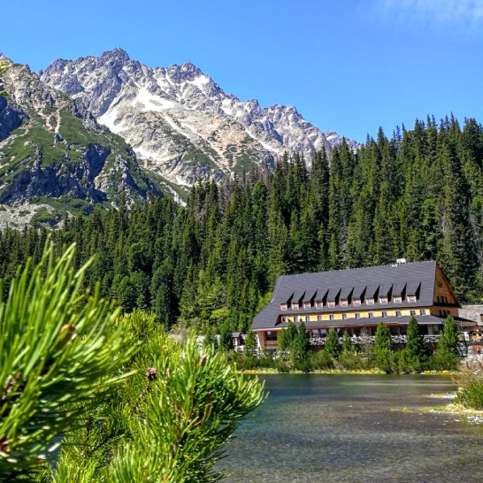
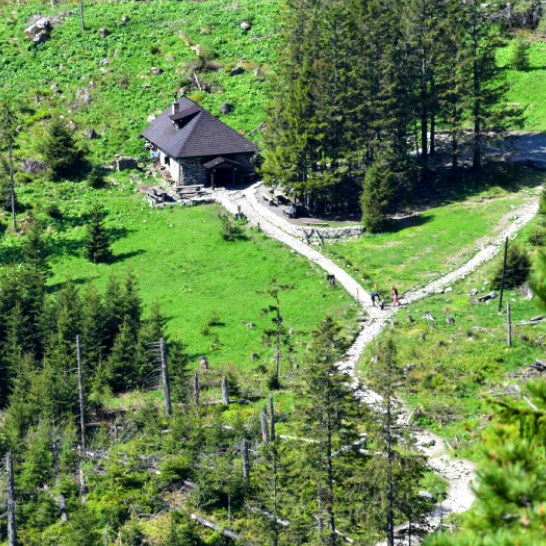
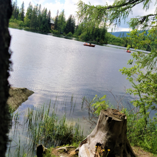
The blue marked hiking trail with an asphalt surface is suitable for tourists with prams as well as for the disabled in wheelchairs. About halfway there is a shelter where you can sit or hide from the rain. Near Popradské pleso there is the Mountain Hotel Popradské pleso, Majláthova chata (chalet) and the Symbolic cemetery of the victims who died in the High Tatras. The trail to the cemetery is not suitable for prams and is only open during the summer season.
- Track: stop of Tatra Electric Railway Popradské Pleso → Popradské pleso/lake
- Length of the track: 8,4 km ↑↓ (MAP)
- Surface: asphalt, consolidated gravel
- Difficulty: medium
- Total Ascent: ↑ 262 m, ↓12 m
- Access to the location: by Tatra Electic Railway, by car – parking next to the train stop
- TATRAS WITHOUT BARRIERS (TATRY BEZ BARIÉR)
The popular route from Starý Smokovec through Hrebienok to Rainerova chata offers an asphalt road or the possibility of riding up by funicular, which is also accessible for prams directly from Smokovec. On the way to Hrebienok it is possible to enjoy the views of Slavkovský štít, Stredohrot and Lomnický štít. From Hrebienok, the red-marked route with a gravel surface continues to Rainerova chata. The waterfalls of Studený potok are only a few minutes away, but we recommend leaving the pram in the shelter.
- Track: bottom station of funicular in Starý Smokovec → Hrebienok → Rainerova chalet
- Length of the track: 8 km ↑↓ (MAP)
- Surface: asphalt, consolidated gravel
- Difficulty: medium
- Total Ascent: ↑ 317 m, ↓ 53 m
- Access to the location: by Tatra Electric Railway, by bus to Starý Smokovec, by car – parking in Starý Smokovec
- TATRAS WITHOUT BARRIERS (TATRY BEZ BARIÉR)
The path around Štrbské pleso is an excellent alternative for a family walk. Paved gravel is not a problem for prams or wheelchairs. The route is also lit after dark, access to the sidewalk is easy and during the walk it is possible to do boating in the summer. Throughout the year, visitors will find information boards, fitness trail, beautiful views and restaurants nearby.
- Start: sidewalk between Hotel Solisko and Grand Hotel Kempinski High Tatras
- Length of the track: 2,3 km – circuit (MAP)
- Surface: asphalt, consolidated gravel
- Difficulty: easy
- Total Ascent: ↑ 14 m, ↓ 11 m
- Access to the location: by Tatra Electric Railway, by bus to Štrbské Pleso, by car – parking in Štrbské Pleso
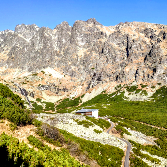
Asphalt road to Sliezsky dom at an altitude of 1670 m. leads directly from Tatranská Polianka and is also marked as a cycling route. The route is relatively long for strollers, but in the end, it offers wonderful views of the surrounding peaks and the nearby tarn Velické pleso. The highest elevated hotel in Slovakia – Mountain Hotel Sliezsky dom offers restaurant services, buffet, restrooms, sun terrace and accommodation with wellness. In 1995, it was also visited by Pope John Paul II, who during his visit, consecrated a wooden cross, which is still here today.
- Track: Tatranská Polianka → Sliezsky dom
- Length of the track: 14 km ↑↓ (MAP)
- Surface: asphalt
- Difficulty: hard
- Total Ascent: ↑ 670 m, ↓ 16 m
- Access to the location: by Tatra Electric Railway, by bus to Tatranská Polianka, by car – parking in Tatranská Polianka
BIELOVODSKÁ DOLINA
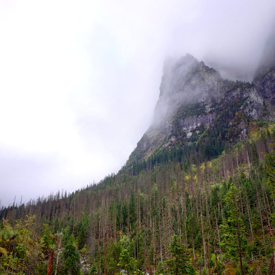
This track offers an amazing walk crossing one of the biggest valleys in Tatras along the stream Biela voda and across forest slopes and meadows. Blue marked trail with hard gravelled surface starts from the border crossing Lysá Poľana and ends at the gamekeeper’s lodge Biela voda. It is possible to continue walking further but just on unpaved road. Interesting fact is that Biela voda is a border river between Slovakia and Poland, the possibility of crossing the Slovak-Polish state border is in Lysá Poľana.
- Track: bus station AS Tatranská Javorina / Lysá Poľana → Gamekeepers house Biela voda
- Length of the track: 6,4 km ↑↓ (MAP)
- Surface: asphalt, cart-track
- Difficulty: easy
- Total Ascent: ↑ 47 m, ↓ 6 m
- Access to the location: by bus, by car – parking lot 200 m from the hiking start
- TATRAS WITHOUT BARRIERS (TATRY BEZ BARIÉR)
Area of the botanical garden is situated just 5 minutes walking from the Museum of Tatra National Park and 10 minutes from the bus station. The exposition of Tatra nature presents to the visitors around 290 herbs and trees starting with flora of submontane meadows and ending with vegetation of the alpine level. Palisade path over the peat bog and access path to a green tarn which is situated in the back part of the garden. The garden is open from may to september. Educational trail Pramenisko starts from the garden (although it is not suitable for prams).
- Start: Tatranská Lomnica
- Area: 8,2 ha
- Surface: consolidated gravel
- Difficulty: easy
- Access to the location: by Tatra Electric Railway, by bus, by car – parking lot Tatranská Lomnica
The asphalt road from Tatranská Lomnica leads directly below Lomnický štít to the Štart cable car station. This road is also marked as a bike path, it can be slightly challenging for prams and wheelchairs. On Štart there is a possibility of refreshments in the restaurant Pizza & Pasta Štart where pizza and pasta are served. To Skalnaté pleso at an altitude of 1754 meters it is possible to continue by cable car with a small stroller up to 58 cm wide.
- Track: parking lot by the cable car station Tatranská Lomnica → Štart
- Length of the track: 6 km ↑↓ (MAP)
- Surface: asphalt
- Difficulty: medium
- Total Ascent: ↑ 260 m, ↓ 0 m
- Access to the location: by Tatra Electric Railway, by bus, by car – parking lot Tatranská Lomnica
Gravelled hiking trail crosses Javorova dolina valley along the stream Javorinka. On this trail you can see a unique geological exposition which you can find on the blue marked hiking trail before entering the valley. Moreover, you can visit beautiful wooden church of Saint Anna or Hunting lodge Hohenlohe in Tatranská Javorina.
- Track: bus stop AS Tatranská Javorina → Gamekeepers house Podmuráň
- Length of the track: 4,2 km ↑↓ (MAP)
- Surface: consolidated gravel
- Difficulty: easy
- Total Ascent: ↑ 78 m, ↓ 0 m
- Access to the location: by bus, by car – parking lot 500 m from a hiking trail
- TATRAS WITHOUT BARRIERS (TATRY BEZ BARIÉR)
The asphalt cycle route suitable for prams starts in Podbanské and offers an 8.5 km long ascent to Kmeťov vodopád waterfall in Kôprová dolina. The waterfall is the longest waterfall in Slovakia (80 m) and the route leads to it through Horáreň Tichá and the crossroads below Grúnik along the Kôprovský potok brook. The waterfall is glacial with two levels that fall through a crack over a rocky threshold. The road offers no refreshments or sanitary facilities, only a forest and views of beautiful nature.
- Track: Pod kravskou cestou, Podbanské → Kmeťov vodopád waterfall
- Length of the track: 16 km ↑↓ (MAP)
- Surface: asphalt, consolidated gravel
- Difficulty: medium
- Total Ascent: ↑ 311 m, ↓ 0 m
- Access to the location: by bus, by car – parking lot Podbanské
Along the Cesta Slobody road, the trail stretches across the entire Tatras from Vyšné Hágy, through Tatranská Polianka to Tatranská Matliare. However, the most suitable surface for prams is in the section between Starý Smokovec and Tatranská Lomnica. The undemanding route also passes through Horný Smokovec, Tatranská Lesná and Stará Lesná. From Tatranská Lomnica it is possible to continue along the asphalt path to Tatranské Matliare (1.6 km).
- Track: Starý Smokovec bus station → Tatranská Lomnica bus station
- Length of the track: 12 km ↑↓ (MAP)
- Surface: asphalt, consolidated gravel
- Difficulty: easy
- Total Ascent: ↑ 0 m, ↓ 151 m
- Access to the location: by Tatra Electric Railway, by bus, by car- parking lot S. Smokovec or T. Lomnica
Very beautiful views of the main ridge of Roháče, Ostrý Roháč and Volovec are offered to the visitors during the walks across this valley with varied fauna and flora. Red marked tarmac path starts from Zverovka and ends next to former Ťatliakova chata chalet. The path is lined with 8 educative boards beginning from the parking in Zverovka up to the third Roháčske pleso lake.
- Track: Junction Rázcestie Zverovka (bus stop AS Zuberec, Ťatliakova chata, razc.) → Former Ťatliakova chata chalet
- Length of the track: 9,4 km ↑↓ (MAP)
- Surface: asphalt, consolidated gravel
- Difficulty: medium
- Total Ascent: ↑ 346 m, ↓ 0 m
- Access to the location: by bus, by car – parking lot under the ski slope Spálená
- TATRAS WITHOUT BARRIERS (TATRY BEZ BARIÉR)
The more than 8 km long nature trail through the Dunajec Gorge has ten stops with the theme of nature, forestry and history. A gravel walkway leads along the Dunajec River. In the locality it is possible to see the Carthusian Monastery (Červený kláštor – „Red Monastery“), which is also a National Cultural Monument and which was founded in 1319 by Kakaš Berzevici. The rafting of the Dunajec with Gorals in traditional costumes is also a beautiful experience.
- Track: Červený Kláštor – Lesnica
- Length of the track: 16 km ↑↓ (MAP)
- Surface: consolidated gravel
- Difficulty: medium
- Total Ascent: 25 m
- Access to the location: by bus, by car – parking lot Červený Kláštor or Lesnica
- TATRAS WITHOUT BARRIERS (TATRY BEZ BARIÉR)
